Drone Services
What sets our Drone Services above everyone else?
Our Premium Equipment
Brungardt Enterprises, L.L.C. uses enterprise level drones designed to carry the heavy payload of a cinematic quality camera and improved on-board gps accuracy. Additionally, we utilize an RTK drone which uses a ground station to improve gps accuracy.
Why is this important?
The quality of the image and the geo coding on the image help to stitch a more accurate mosaic image of your entire site, as well as providing more accuracy of ground data resulting in more accurate 3D information.
Licensed Pilots
All our pilots are FAA part 107 licensed. We are familiar with obtaining FAA approvals and working with the Air Force and control towers for our flights.
Much more than just a pretty picture
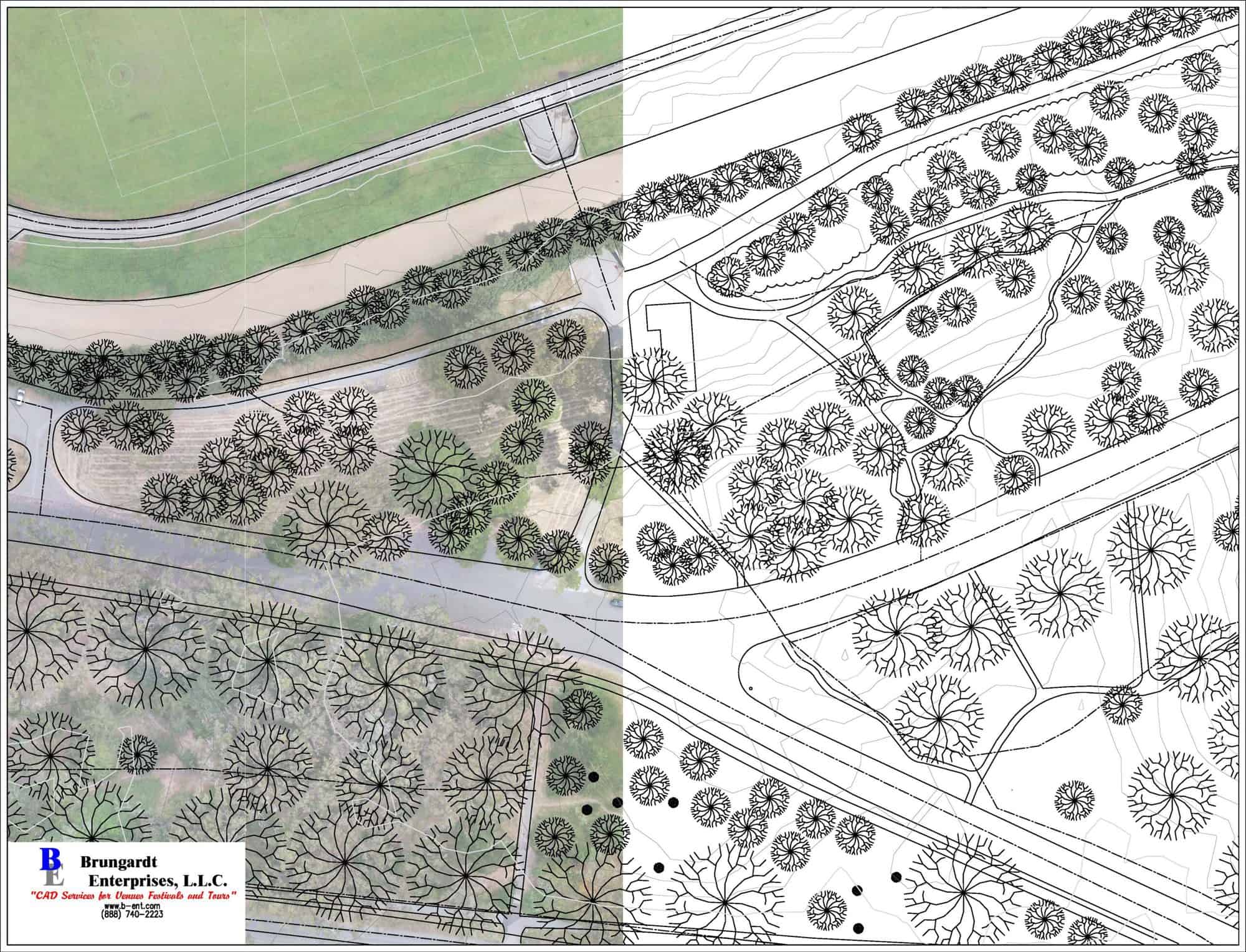
With our decades of experience in the design industry, we don’t just produce pretty pictures, we can bring the Geotagged image into AutoCAD in real world coordinates. This allows them to be used for backgrounds for design projects, backgrounds for Construction Progress Monitoring.
AutoCAD Civil 3D and AutoCAD
We can bring the images into AutoCAD Civil and develop line drawings, 3D topographic information as well as a 3D surface.
Our Drone Services
GPS Drone Surveying and Mapping
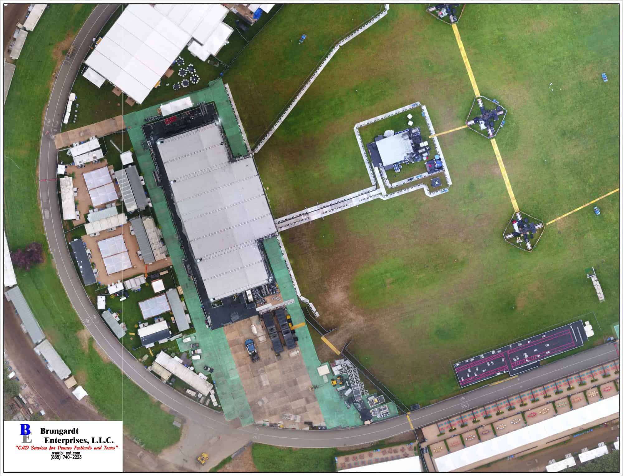
With the accuracy of the output and the extremely high resolution from our images we can create extremely accurate and very clean orthomosaic geo tagged images. With the flexibility of using drones we can capture current sites and progressive images with ease. Whether these images are used to develop CAD files for a site plan or existing condition As-Built images to archive for future reference our GPS Drone Surveying is the best around.
GPS Drone Construction Progress
Utilizing our highly accurate drones and software we can collect aerial imaging to capture existing conditions and construction progress. Not only can we show the progress in images, we can use those images as underlays on CAD drawings easily identifying any issues and documenting progress.
GPS Drone Inspections
Whether you need to inspect Towers, Pipelines, Roofs, or anything at all we can grab the images you need. With our high-resolution images and our ability to take 4K video it is easy to identify any issues.